Most people visit Peru for Machu Picchu, the ancient Inca citadel nestled between the mountaintops around Cusco. But the country has much more to offer than its most popular tourist destination. At Lake Titicaca, for example, travelers can explore the traditional dwellings of the Uros, an indigenous people that lives on floating islands made of straw and reed.
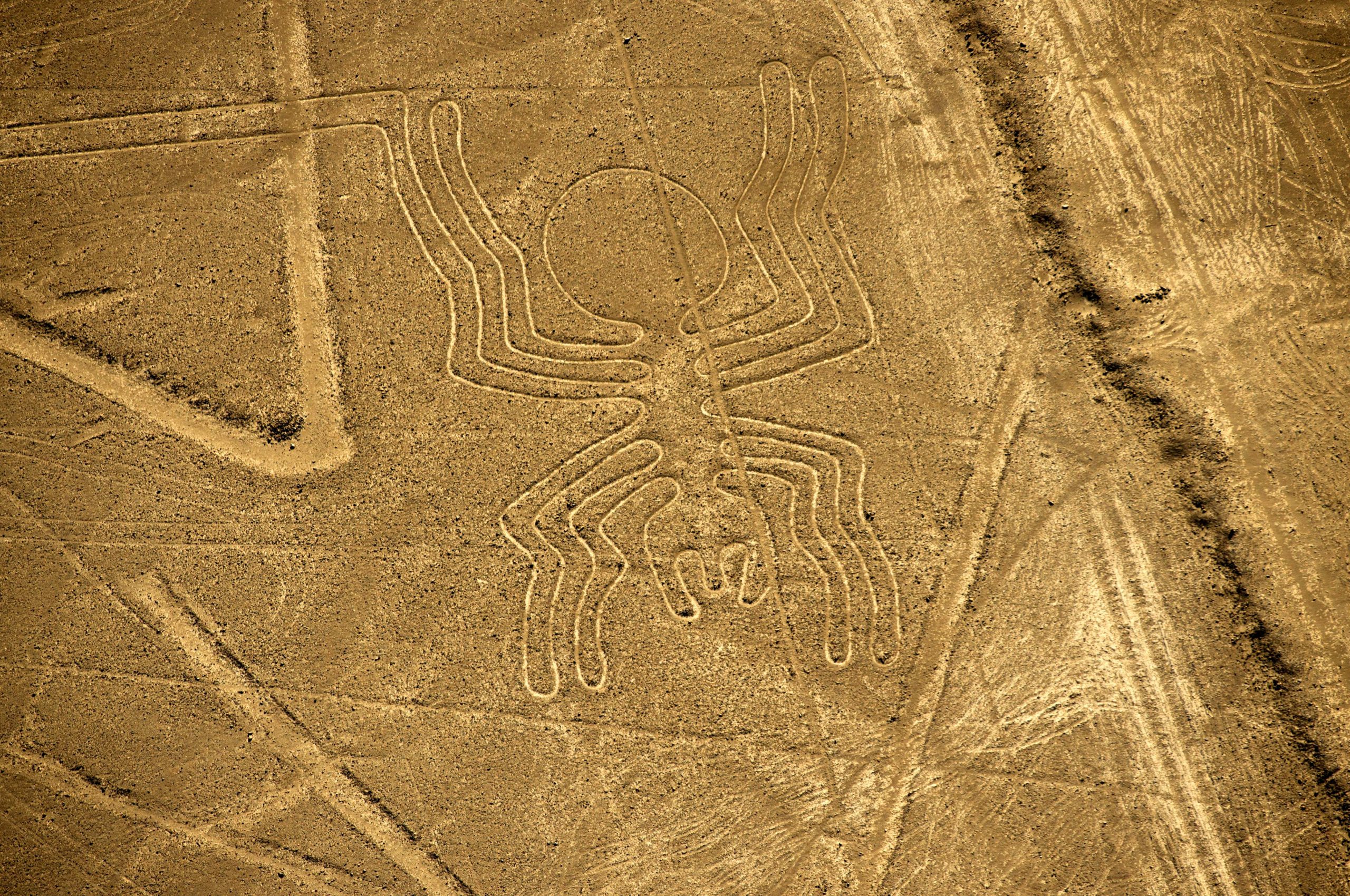
Equally breathtaking are the so-called Nazca Lines: giant rock formations near the capital city of Lima that, when viewed from a hilltop of hot air balloon, take the shape of intricate geometric patterns, stick-figures and animals.
A treasured World Heritage site, the Nazca Lines have been the subject of numerous scientific studies since they were discovered by the Peruvian archeologist Toribis Majia Xesspe in 1927. Aerial photography surveys, which began in the 1940s, previously identified 430 geoglyphs. But the Nazca Lines cover an area of roughly 450 square kilometers—too much land for any human being to thoroughly investigate.
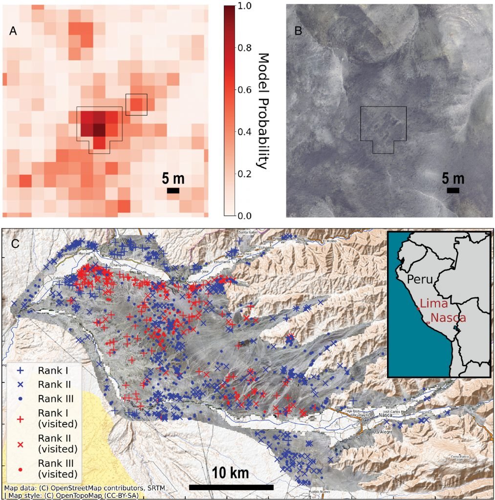
Some newly discovered geoglyphs. Photo: Sakai et al. / PNAS.
That’s why a group of researchers from Yamagata University, the Université Paris, and the IBM Thomas J. Watson Research Center decided to tackle the problem with the help of A.I. Taking a page from the Vesuvius Challenge, in which programmers used machine learning to decode heavily damaged scrolls that miraculously survived the eruption of Mount Vesuvius, they trained an algorithm to find patterns in grainy aerial photographs that human eyes cannot perceive.
With this tool, the researchers were able to discover 303 new figurative geoglyphs, doubling the number of known megaliths in the region. They report, in their study published in the Proceedings of the National Academy of Sciences (PNAS) in September 2024, that most of the geoglyphs depict humanoid figured, decapitated heads, and domesticated animals like llamas.

A geographic distribution of the newly discovered geoglyphs. Photo: Sakai et al. / PNAS.
The results demonstrate the academic utility of artificial intelligence. “Even with limited training examples,” they write, “the developed A.I. approach is demonstrated to be effective in detecting the smaller relief-type geoglyphs, which unlike the giant line-type geoglyphs are very difficult to discern.”
While the researchers have nearly doubled the number of known geoglyphs, the origin of the infamous Nazca Lines remains shrouded in mystery. Pottery shards distributed near the formations suggest they were constructed by the Nazca people between 100 B.C.E. and 50 C.E. But why?
Some scholars argue the lines functioned as a cosmic calendar, not unlike other ancient megaliths like Stonehenge. Others have suggested they served a more practical purpose, possibly related to agriculture and irrigation. Others still have proposed they functioned like a map, helping Nazca families navigate their vast territory the way modern travelers might consult a map.


